


Ironton City Voting District, Crow Wing County, Minnesota
About
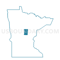
Outline

Summary
| Unique Area Identifier | 601665 |
| Name | Ironton City Voting District |
| County | Crow Wing County |
| State | Minnesota |
| Area (square miles) | 2.00 |
| Land Area (square miles) | 1.48 |
| Water Area (square miles) | 0.52 |
| % of Land Area | 73.94 |
| % of Water Area | 26.06 |
| Latitude of the Internal Point | 46.48185450 |
| Longtitude of the Internal Point | -94.00396050 |
Maps


Graphs
Select a template below for downloading or customizing gragh for Ironton City Voting District, Crow Wing County, Minnesota


Neighbors
Neighoring Voting District (by Name) Neighboring Voting District on the Map
- Crosby P-2 Voting District, Crow Wing County, MN
- Irondale Twp. Voting District, Crow Wing County, MN
Top 10 Neighboring County Subdivision (by Population) Neighboring County Subdivision on the Map
- Crosby city, Crow Wing County, MN (2,386)
- Irondale township, Crow Wing County, MN (1,134)
- Ironton city, Crow Wing County, MN (572)